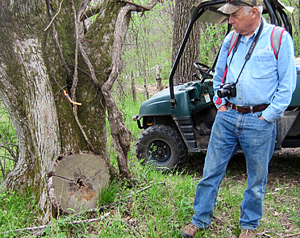
Calling attention to a section of the trunk of a downed tree, retired Ferrell- Duncan gastroenterologist and dedicated Master Naturalist Dr. Bob Kipfer explained the process of determining the tree's age by counting the visible growth rings. This particular tree on his property in southern Christian County, he said, dates back to the Civil War.
Organized by the Southwest Chapter of the Missouri Native Plant Society and sponsored by property-owners Barb and Bob Kipfer, the annual Bull Mills Wildflower Walk was held on April 16, 2016. The property----originally consisting of about 85 acres purchased by the Kipfers in 1995--and now considerably larger-- has been an on-going preservation project, especially in the creation and maintenance of a healthy creek and in battling invasive species like sericea lespedeza that prohibits the preservation of native plants. Re-routing a mile-long section of Bull Creek to its original channel was a challenge the Kipfers took on with the help of the Missouri Department of Conservation.
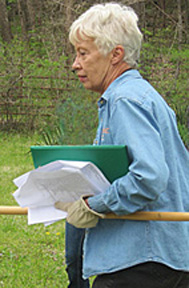
Barb Kipfer, pictured at right, led the group of nature lovers down a gravel path flanked on both sides by vegetation. Armed with a list of native plants, she stopped often to point out one of them to her guests. The retired nurse, like her husband, is a dedicated Master Naturalist as well as an active member of many other local groups focusing on ecology and conservation.
With an active imagination a person could visualize a skirmish here and there between Union forces and the Confederates during the time of the Civil War. Of historical significance, the land was part of the trail linking Springfield to northern Arkansas. (According to a Missouri postal history website Bull Mills had an operational post office in Christian County--formerly Taney County--on and off between the years of 1840 and 1873.) It also had a gristmill/lumber mill that was established in 1833, but the only signs left of it, according to Dr. Kipfer, may be metal pylons discovered along the creek bank.
Often involved in living history as a re-enactor, Dr. Kipfer likes to mention how explorers Henry Rowe Schoolcraft and Levi Pettibone from New York state traveled through the area in 1818-19, and how in Schoolcraft's journal we learn that his impression of the area gained from hunters whom he met was one of sterile hills of such similarity that it was "a dangerous place to get lost in, particularly in foggy weather." (But even a light mist seems to add to the serenity and beauty of the area.)
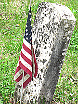
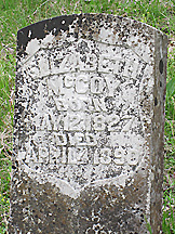
These old military gravestones mark the place where Captain John McCoy and his wife Elizabeth were laid to rest in the Cobb Keeton Cemetery. Dr. Kipfer wondered why she was privy to the headstone issued by the government; perhaps, he speculated, she was a nurse in the Civil War.
The Cobb Keeton Cemetery was part of the tour. Before the Kipfers reclaimed them, the headstones in the cemetery were hidden by very tall overgrowth. Finding stories behind the headstones attracted the love of history both Kipfers pursue. Their research discovered, for example, how a unique pointy-shaped stone had been designated as a headstone for a child dying prematurely, how matching headstones marked the graves of Union Captain John McCoy (no relation to the feuding McCoys) and his wife Elizabeth. (She was the daughter of Richard Jones, operator of the 1833 grist mill.) The Kipfers related how the McCoys had moved to the area in 1841, although their son took his bride to start a family in northern Arkansas, only to return with his family and several others in order to escape the roving bandits that were terrorizing the area in which they had settled.
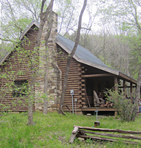
As the trail came to an end a log cabin, pictured, came into view with a welcoming porch that served as a respite for the hikers. It was one of two buildings on the property, the other accessed by crossing the creek (in suitable vehicles). Its location on a bluff serves as inspiration for the Kipfers' artistic side. Besides the collection of acrylic paint visible through a window, Dr. Kipfer's intricately balanced wire mobiles could be seen. A collection of stones sat on an outside table. Each had a natural hole (or holes) for stringing. A completed stone mobile hung nearby.
The group's final visit was to an area of land reclamation, a prescribed burn. It is this method of invasive species control that takes place all over the property.
Pictures speak louder than words. Click on any thumbnail to start a slideshow.


Comments